INTEGRASYS Introduces EO Master the AI, ML Object Characterizer
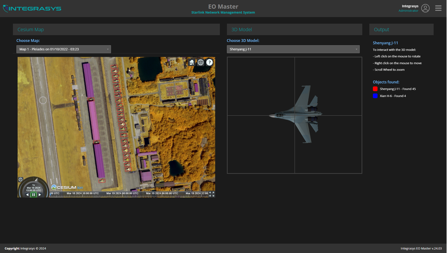
EO Master allows characterizing objects in real time for reducing the time and decision making in GEOINT applications by comparing images with 3D models, including but not limited to latest eastern military platforms. Currently, Earth Observation over SAR and optical has become essential in any power-to-power war, however, tools are proprietary to each provider or EO technology which locks providers and force users to utilize multi-platforms. EO Master is the first to cover optical and SAR image processing and target characterization used by government users without deep analysis knowledge to determine and compare real versus fake as well as traffic and population patterns.
In a more tense world that we live in, Earth Intelligence is crucial and only with our eyes in the space is possible. Nevertheless, situations change rapidly and timing of data transfer in space is not swift, therefore tools to characterize must enable a minimum time analysis with API machine to machine automation for fast decision making under threats. EO Master has a restful API to generate results, reports or connect with other systems, one example is to complement InterGeo signal geolocation to obtain an even greater accuracy and determination, especially for on the move platforms lost mile geolocation with sub 50cm accuracy.
“We believe there are endless use cases to automate GEOINT analysis and at INTEGRASYS we are glad to support with EO Master and customize for user application with requiring access to any data stand alone and secure”, said Alvaro Sanchez, CEO at INTEGRASYS.